|
|
|

My site is actually pretty boring if you think about it. It's a compilation of road junction listings. Wow. It's hard for the average citizen to get shook up over freeway junctions, never mind the minutiae that I get hung up in...Just the same I like to imagine that someone actually cares enough about this site to actually try and figure out what's going on. This is the page for those stalwart souls.
These screens have lotsa info on them: The highway you're on, what the mileages are and what's available at the roadside(on the freeway lists)
The format works like this:
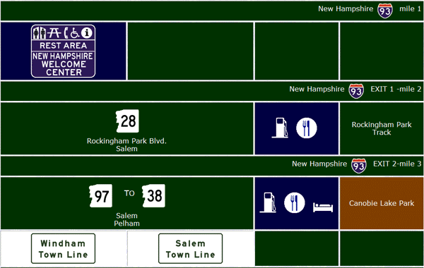
If services are included they are in blue-colored cells; usually represented by graphical symbols. Also noted are transport-related services.
Recreation and culture are shown in brown cells.
I design my pages with Mozilla browsers in mind. They work just as well in IE.
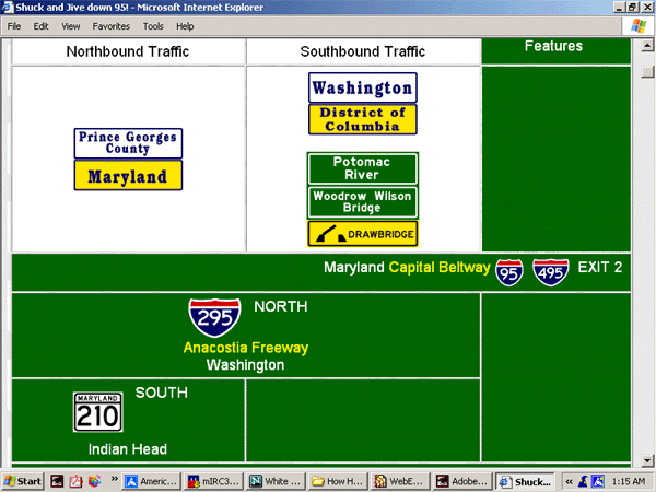
Here is an IE 6.66 screen shot.
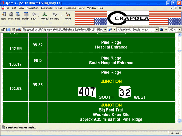
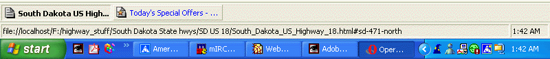
Here's Opera, here displaying a regular highway junction
list.
The leftmost columns are mileage information; the right, junction
information.
I don't like Opera, cos it j�tes my formatting: there are
some HTML commands it doesn't dig, like <texttop>.
Plus, there's that ad window(scientifically j�tated in this
example).
Here's
a shot of a listing where I did the mileage myself using my mapping software,
of course, you'll be adequately warned if that is the case. On
lists that feature roads with level junctions, the mileage field is in white,
and the type of junction is shown-mind that these apply to the direction
of the table -so if you're scrolling up from the bottom, you'll have to
stand on your head. This does not apply to the South Dakota State Highway pages
as they're ALL level junctions.
Of course, things change over time and frequent visitors may notice some NEW formatting:
This is a Cascading Style Sheet list.
This
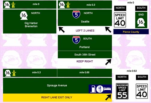
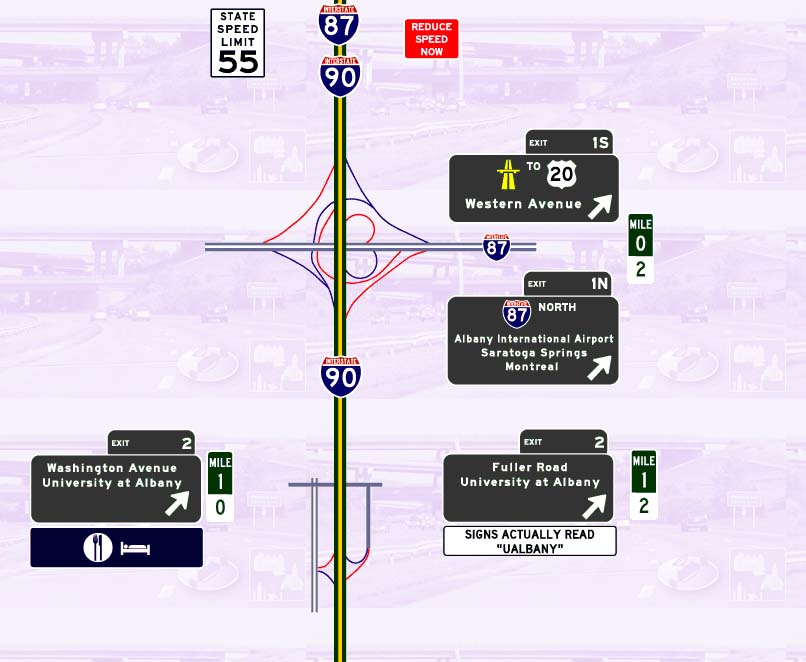
is an image-based page. Here I've made a basic strip map,
and adorned it with cute little sines and junction diagrams.
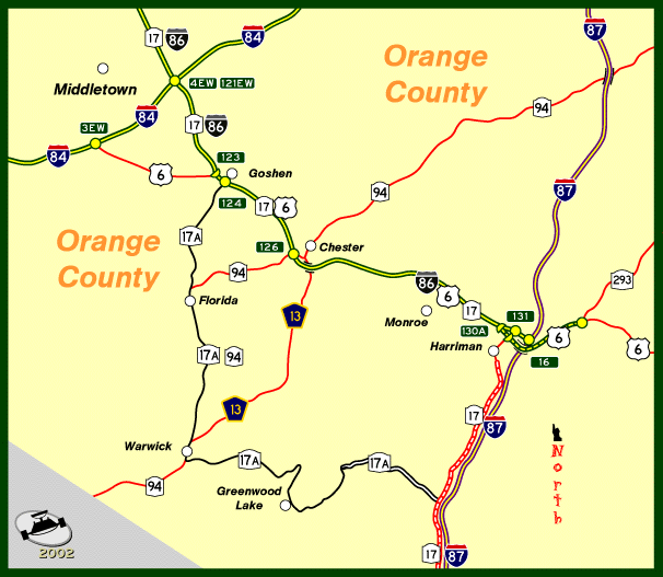
And more often than not, you'll also find maps of the routes in question-these are for basic orientation and point out only the most important points.
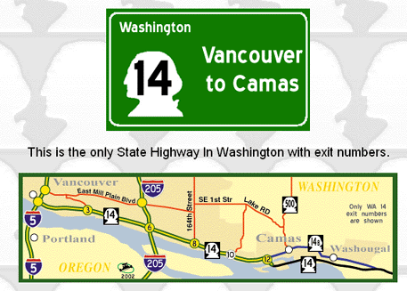
A "Yellow" Map
A "Blue" map


![]()
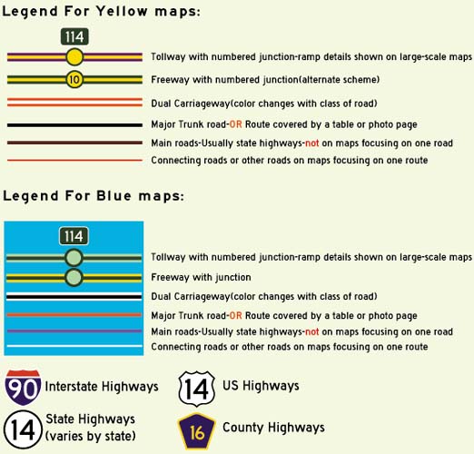
Well that's all well and good, but what does it all mean? You say the pages are spiffy� and colorful and stuff, but you still can't make head or tail out of them? Well, I use colors with a specific aim in mind:
|
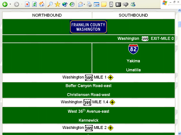
This green is the main table color, since that's the color of most highway signs(this looks like a dark green if you're screen resolution is 1024�768, anything below that, and it looks very nearly black. Sorry.).There's numbered highways, street names and exit destinations in green boxes. Yellow lettering is for freeway names and to emphasize junctions. The freeway symbol(the rightmost ones) indicates a Non-interstate freeway, and is next to the highway number in most newer tables. Supplemental information is shown thusly: Colors may vary. The older tables are this color(this is being phased out). |
|
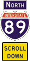
On
newer tables this lighter green color appears near links to indicate
which way you'll need to scroll, or if a route begins or ends. |
|
Purple
is used for tollway listings. Yellow lettering points out freeway and tollway names; though guide signs are still green. |

Blue
is for motorist services or rest/parking areas. |
|
Brown
is for recreation and culture. |
|
Yellow
is for hazards. |
Orange
is for construction. |
|
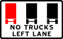
White is for regulations and sometimes for county lines, and whenever I feel I want to get your attention. It beats getting conked with an oxygen tank, my usual method of getting someone's attention. Mileage fields for level junctions on partially controlled-access highways are also white. |
| Now
I also use this color to alert you that there are level junctions
|
Hopefully, that helps some in explaining how these pages work. If not, just chill and enjoy the colors, man.